


Altimeter with photo stamp .Z12 app for iPhone and iPad
Developer: Lilit Yeritsyan
First release : 26 Apr 2017
App size: 13.56 Mb
Features included
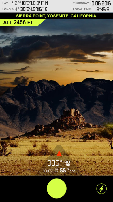
--Take photos with trip info altitude, coordinates, date ,time ,course
--SMS your google map location link
-- Copy and share coordinates
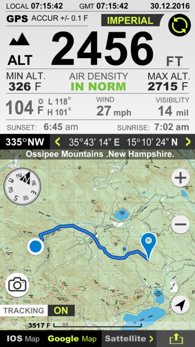
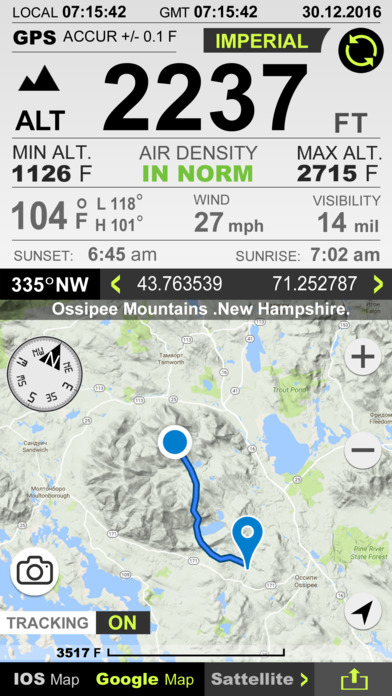
- Imperial and Metric unit settings.
- GPS accuracy indicator.
- GPS distance accuracy indicator.
- Density of air , indicator.
Map integration
-IOS nad GOOGLE maps
- Satellite maps mode.
- Hybrid maps mode.
- Standard maps mode.
- Tracking location changes trajectory.
Compass
- Location coordinates (longitude, latitude).
- Course
Track information
- Max Altitude
- MIn Altitude.
Tracking
- Speed tracking in mph or km/h based on MPH or KM/H mode.
- Distance tracking in miles or kilometers based on MPH or KM/H mode.
- Longitude, latitude coordinates.
Weather
-- Temperature information.
-- Wind
-- Visibility
-- Sunrise,Sunset
-- High/Low Temperature.
-- Ability to switch between Celsius and Fahrenheit.